

Navigating DC's neighborhoods with a new (unofficial) interactive Google map
/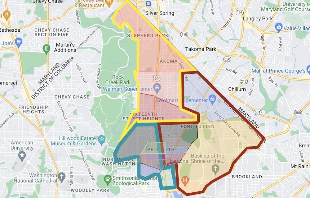
Advisory Neighborhood Commission 4C has partnered with mapping aficionados in MPD’s Fourth District to create an (unofficial) interactive neighborhood Google Map to help residents find their relevant single member district (SMD), MPD Sector and MPD police service area (PSA).
Residents' confusion over where to find their relevant ANC or MPD information often stems from the fact that agencies in DC divide the city’s geography differently. The interactive neighborhood Google map allows residents to view the maps from multiple agencies in the same place, hopefully alleviating some confusion. The map shows ANCs, SMDs and PSAs among different MPD Sectors.
Although the project is unofficial, it's helpful in a number of ways. For example, it makes finding contact information for the MPD Lieutenant who oversees your PSA or identifying your MPD Sector so you can attend the relevant MPD Sector meeting each month easier.
How to Use the Map (see the map full screen)
In the left hand panel, turn off all three layers: ANC/SMD, PSA, Sector.
Search your address.
Navigate back to the left hand panel and turn on the desired ANC/SMD, PSA, or Sector layer for your address. Click on the map where your house is located and the name of the relevant ANC/SMD, PSA, or Sector will appear on the left.
If you have questions or feedback on the map, contact ANC 4C.